
River Liffey Campshires
Architecture Office Urban Agency Architects
Typology Public Realm
Size 1.02 ha
Location Dublin, Ireland
Client Dublin Docklands, Dublin City Council
Status Feasibility, Pre-Planning, 2019
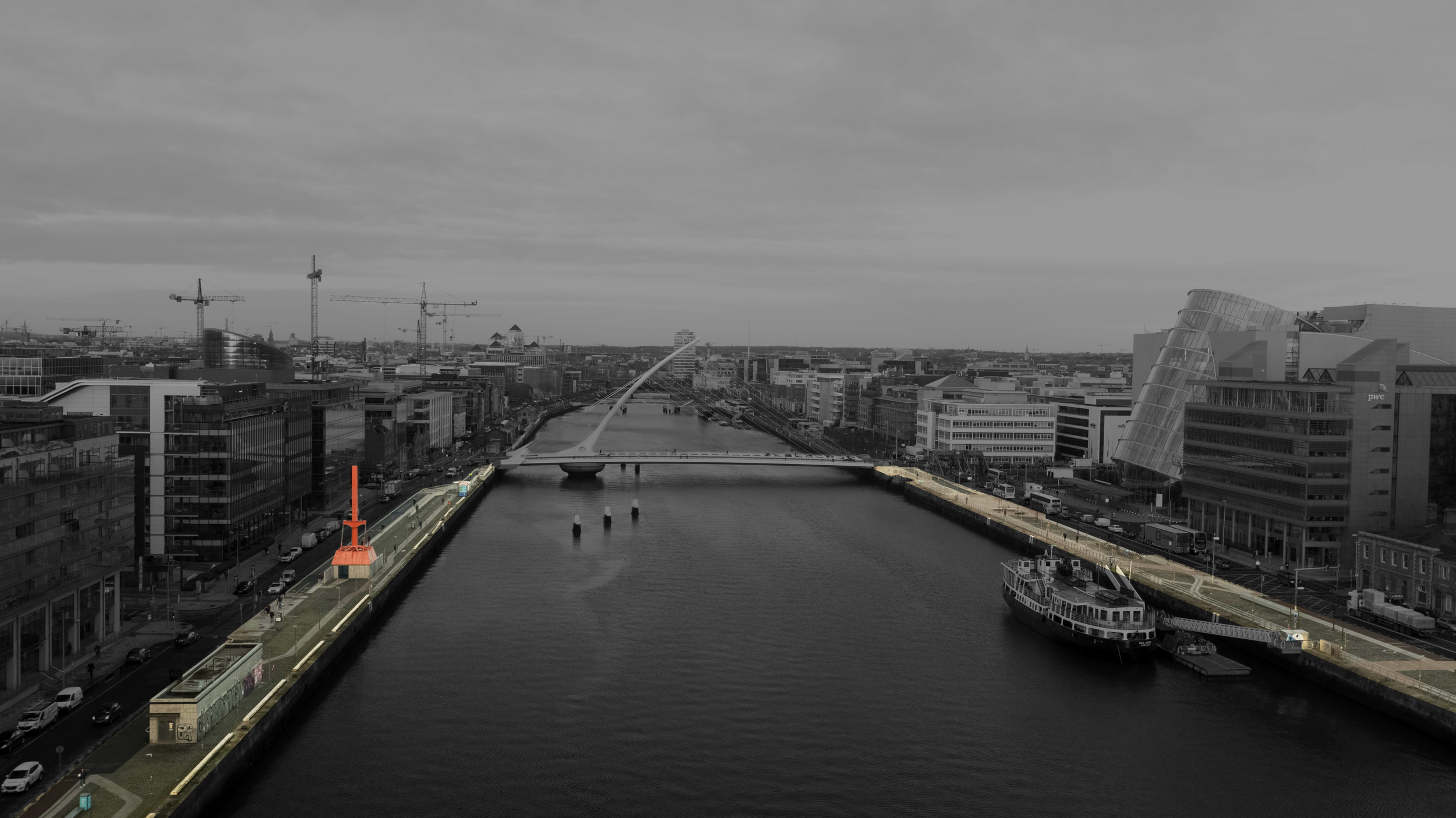
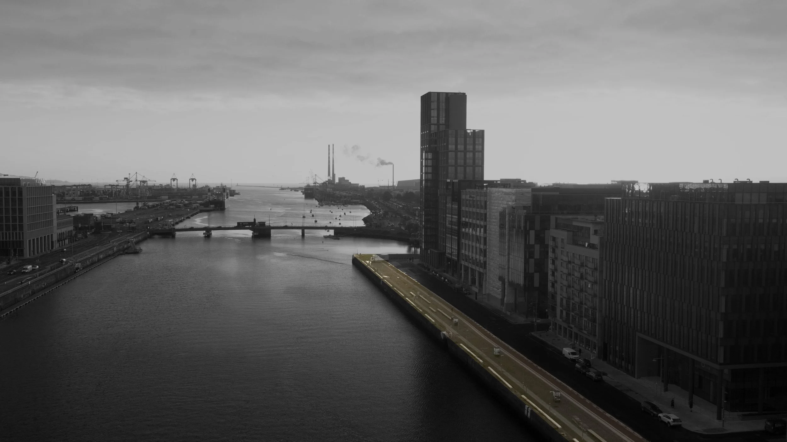
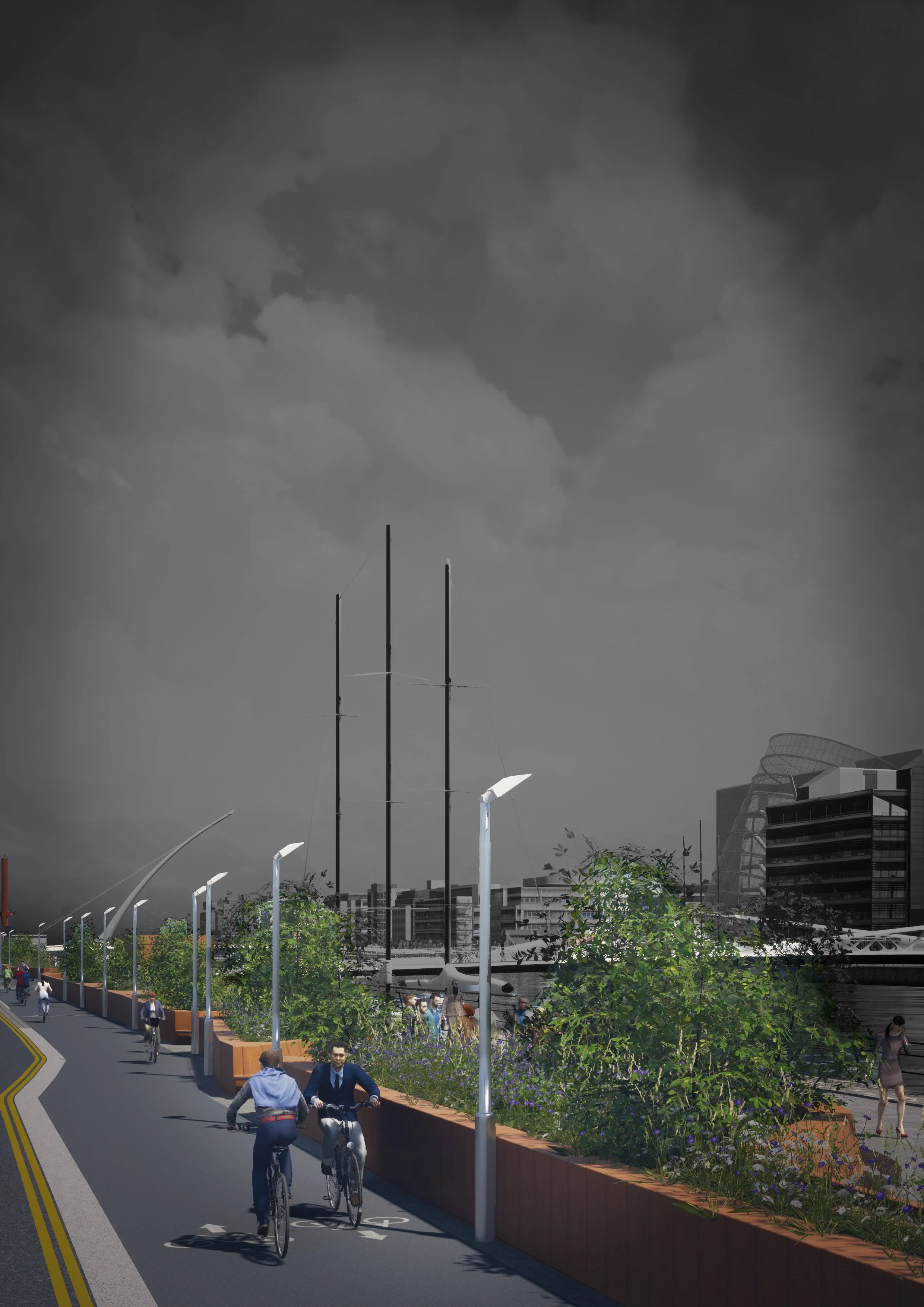
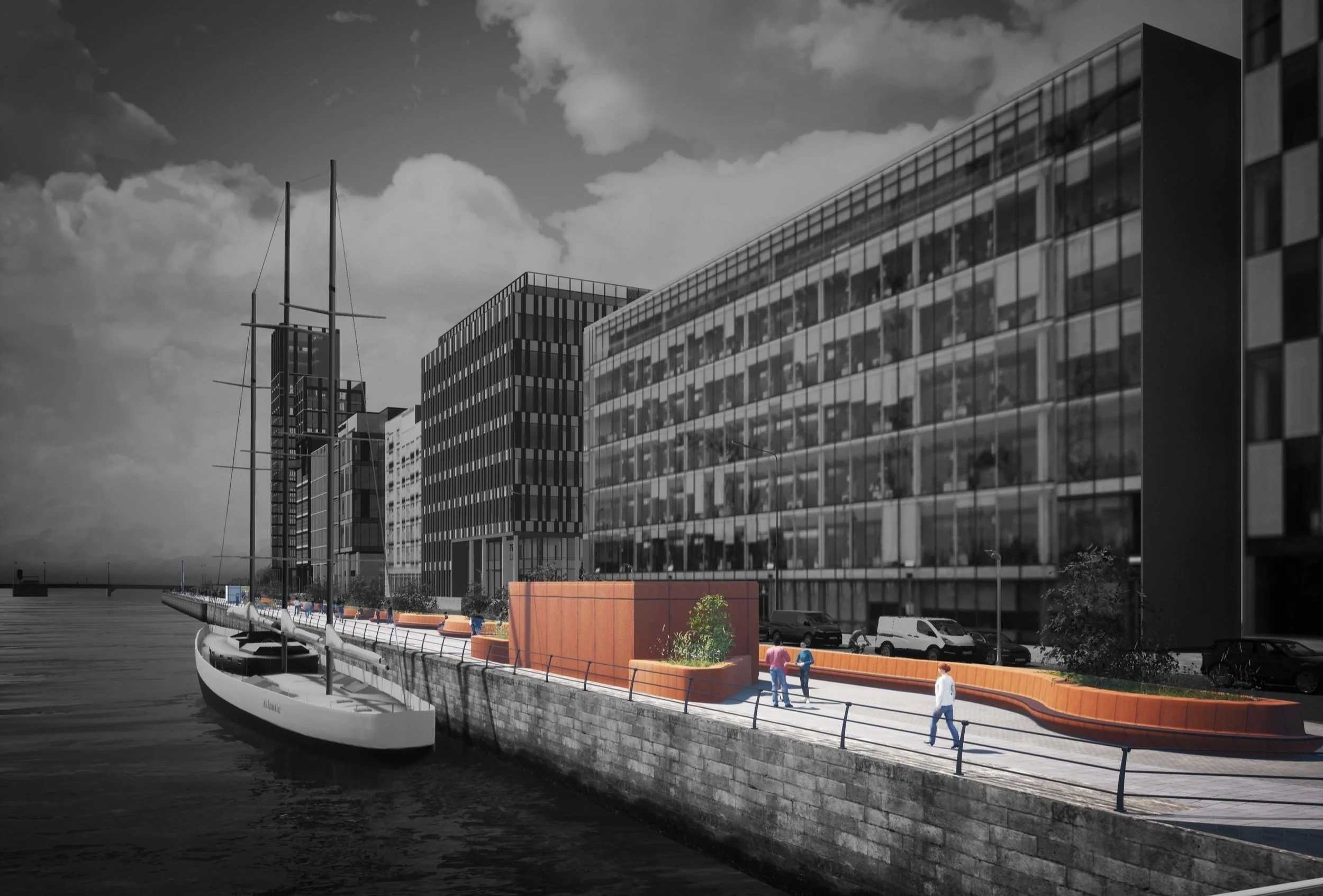
The Campshires are narrow stretches of public land between the River Liffey and the road on the North and South of Dublin’s Quays. Before the Dublin Port facilities moved further East down the river, the ships docked by the Campshires. Testimonies of their nautical past, storage warehouses, cranes, and mooring hooks are still present in the area. Despite the privileged location by the water and in one of the most vibrant city’s neighbourhoods, today the Campshires appear as an empty and inactive corridor space.
Dublin City Council appointed Urban Agency, together with a multi-disciplinary team, to develop a design for a public realm development on the South Campshires of the River Liffey. The project aims to deliver a high-quality integrated public realm for the South Campshires, intending to protect and enhance the area while improving the key infrastructural network along one of the primary civic spaces within the city.
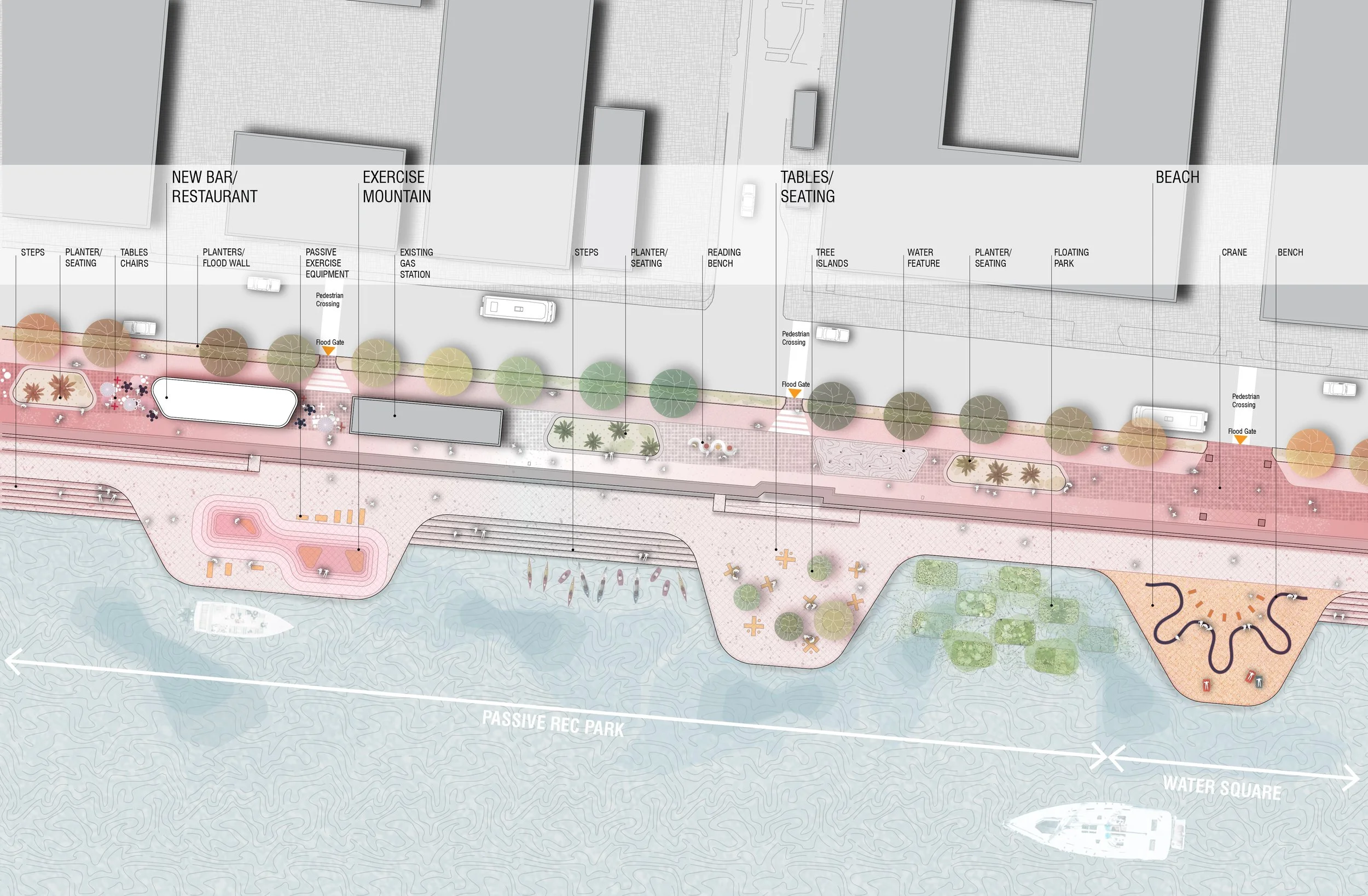
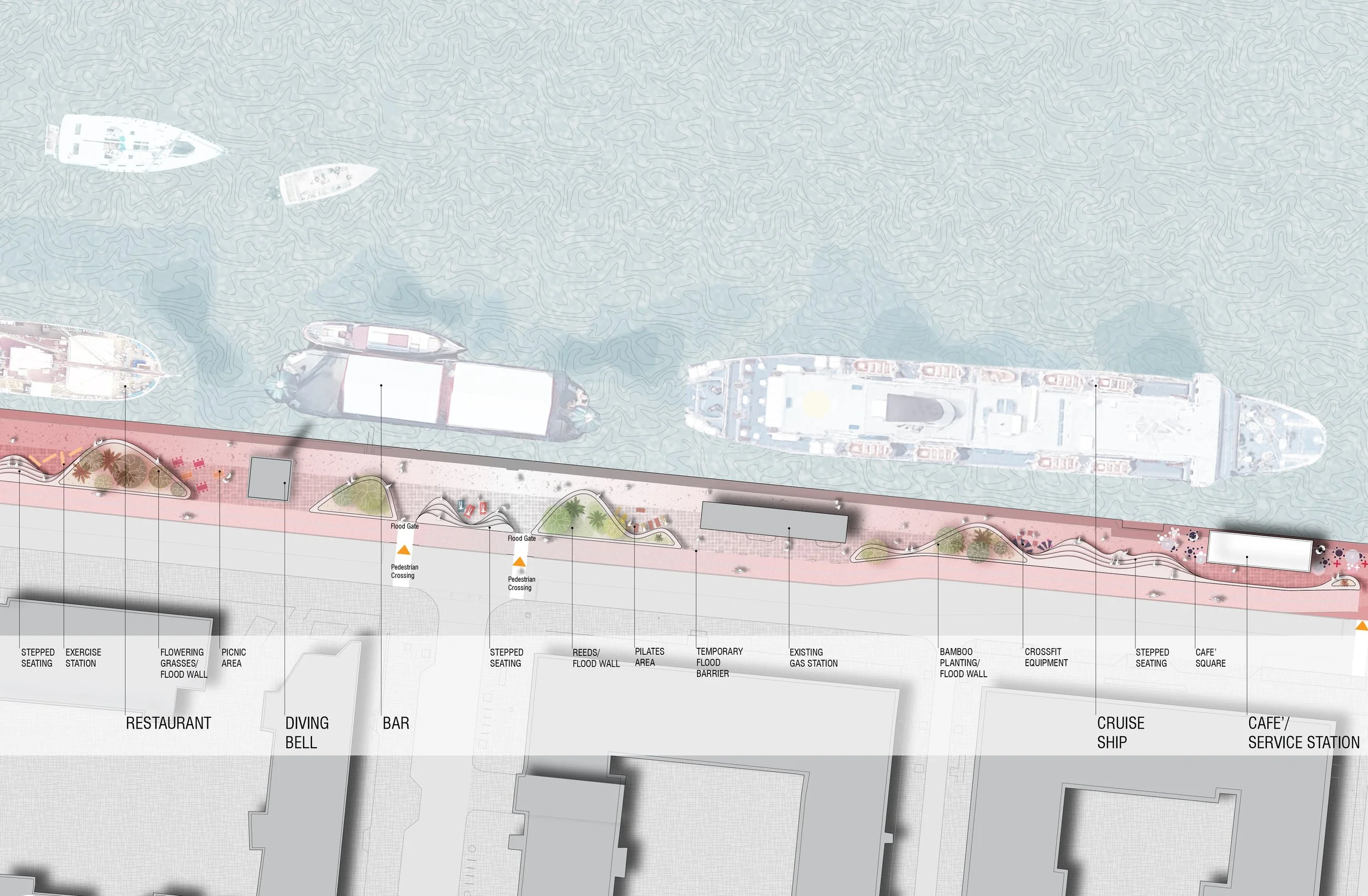
The main project objectives involve the provision of a pedestrian path and cycle track along the South Campshire and of extensive hard and soft landscaping, the inclusion of a flood defense infrastructure along the South Campshire, new drainage, public lighting design and the inclusion of a district heating network pipe, as well as the provision of service utility points for docking vessels/ coffee docks
As Urban Agency’s Project Architect, I led the project until the completion of the pre-planning stage. The initial research phase aimed at developing a masterplan for both the North and the South Campshires: based on the ongoing and forecast projects along the Campshires, the strategy proposes development sites to enhance the riverside public realm and outlines opportunity areas to be developed into water activity amenities. The project area was later limited to the South Campshire only, for which a detailed study and set of pre-planning drawings were prepared.
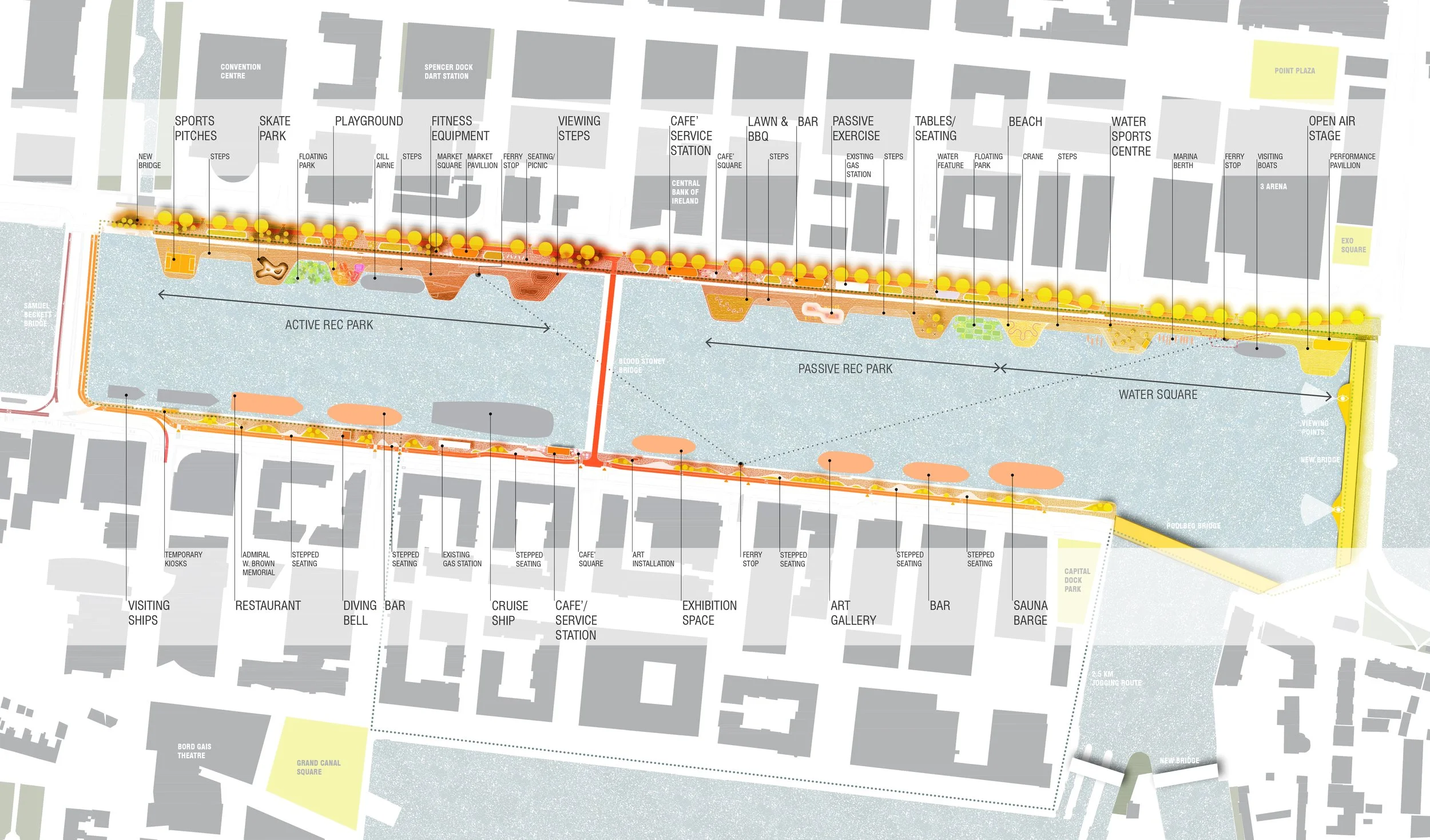
CAMPSHIRES MASTERPLAN
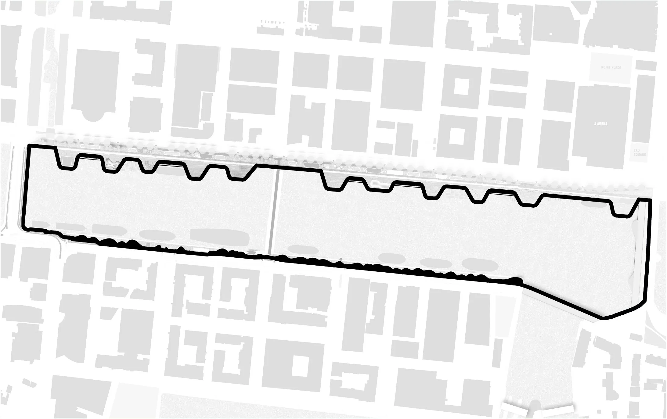
WALKING LOOP

CONCEPT
NORTH CAMPSHIRE
SOUTH CAMPSHIRE
DIVING BELL
Challenges + solutions
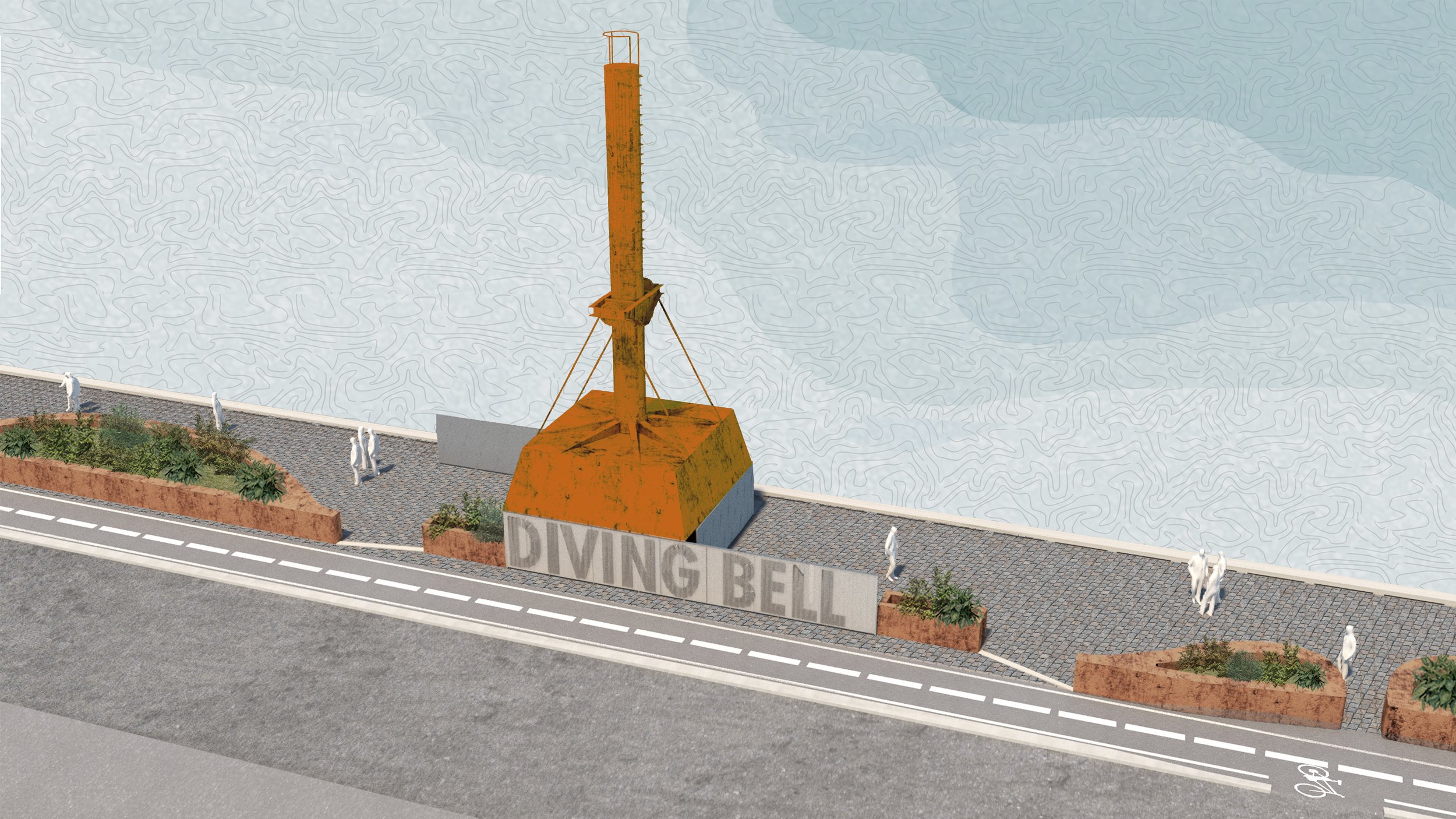
The proposed design considers the existing structures along the South Campshires, such as the Diving Bell and substations/ plants buildings, the new Blood Stoney Bridge and the existing Beckett’s bridge junction. To avoid unpleasant tight passing spaces and to ensure accessibility and ease of use, we investigated alternative measures to optimise the limited pedestrian area and extend it where necessary, by moving the road/ flood defense wall, or extending the quayside space towards the river by introducing new boardwalks.
Relevance
This project allowed me to develop a great skill set in working on large-scale and high-profile public realm projects, which require engagement with a vast number of stakeholders and a detailed public consultation and revision process. The design of the Campshires necessitated a good understanding of infrastructural requirements, crowd circulation, accessibility, technical knowledge, and creativity. In addition, the project’s adjacent protected structures and key features, such as the Wall Quay, the Scherzer Bridges, the Diving Bell, and the existing cobblestone paving required careful treatment, design innovation and Conservation expertise.
SOUTH CAMPSHIRES
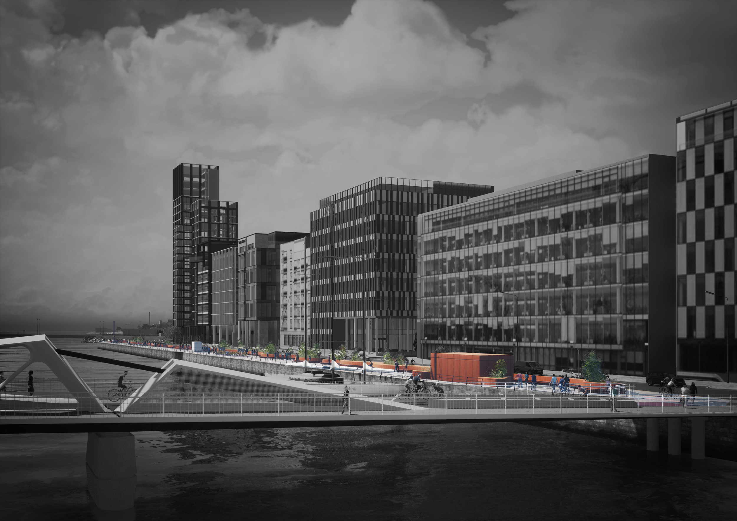
PROPOSED BLOOD STONEY BRIDGE
SERVICE BUILDING AND SEATING
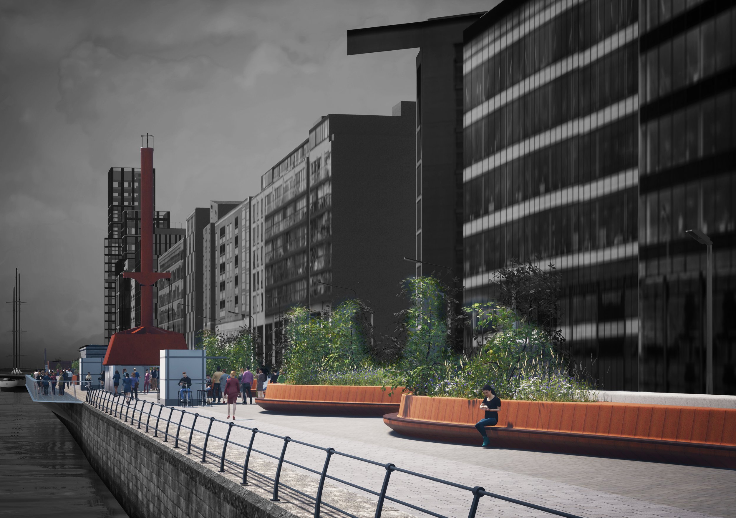
DIVING BELL AND PROPOSED SEATING
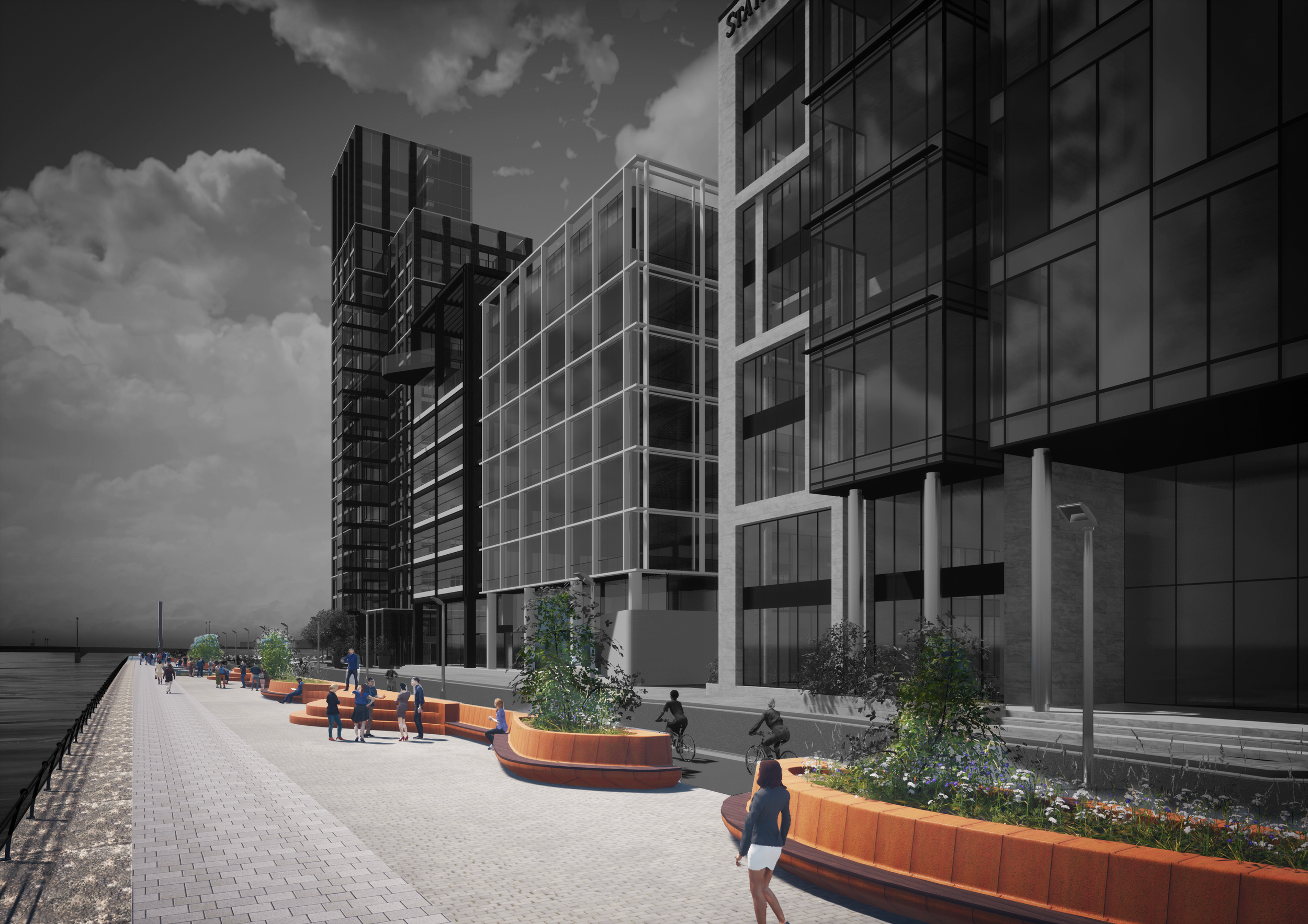
PROPOSED SEATING
CREDITS
Drawings and diagrams: Francesca Tassi Carboni, Urban Agency
3d model: Francesca Tassi Carboni, Urban Agency
Renderings: D3D

CHERRYWOOD T6/T8

TRINITY STREET

SWORDS MASTERPLAN

CLARA MASTERPLAN

SALA BECKETT

GREENING STONEYBATTER STRATEGY

QUAYSIDE PONTOON

CHERRYWOOD T1

TULLOW MASTERPLAN

CAMPSHIRES

MOURNE ROAD CHURCH

CHERRYWOOD T5

FROM EMERGENCY SHELTERS TO HOMES

HADDON ROAD